The GEO Symposium 2023, at which the Post-2025 Strategy and Work Programme Activities were discussed, took place on the 13 and 14 June. It was immediately followed on the 15 and 16 June by the first GEO Open Data & Open Knowledge (ODOK) Workshop.
The Symposium featured interactive dialogues and thematic sessions on topics such as Artificial Intelligence (AI) for good, cropland mapping equity considerations, biodiversity and climate, operational services, early warning systems, urban resilience, and mobilizing resources. Below we summarise the contributions of GEO Mountains to the events.
A key theme was the desire for GEO as a whole to become more integrative, including with respect to socio-economic data, indigenous knowledge, and citizen observations. Such integration would expand the scope of observations and contribute to the concept of "Earth Intelligence". During the opening session, participants engaged in a dialogue about equity considerations in the GEO Post-2025 strategy. Dr. Carolina Adler, MRI Executive Director and GEO Mountains Co-Lead, highlighted the ambitious nature of this Earth Intelligence concept and emphasised the importance of equitable access to data and information, as well as the importance of addressing the specific needs of mountain regions.
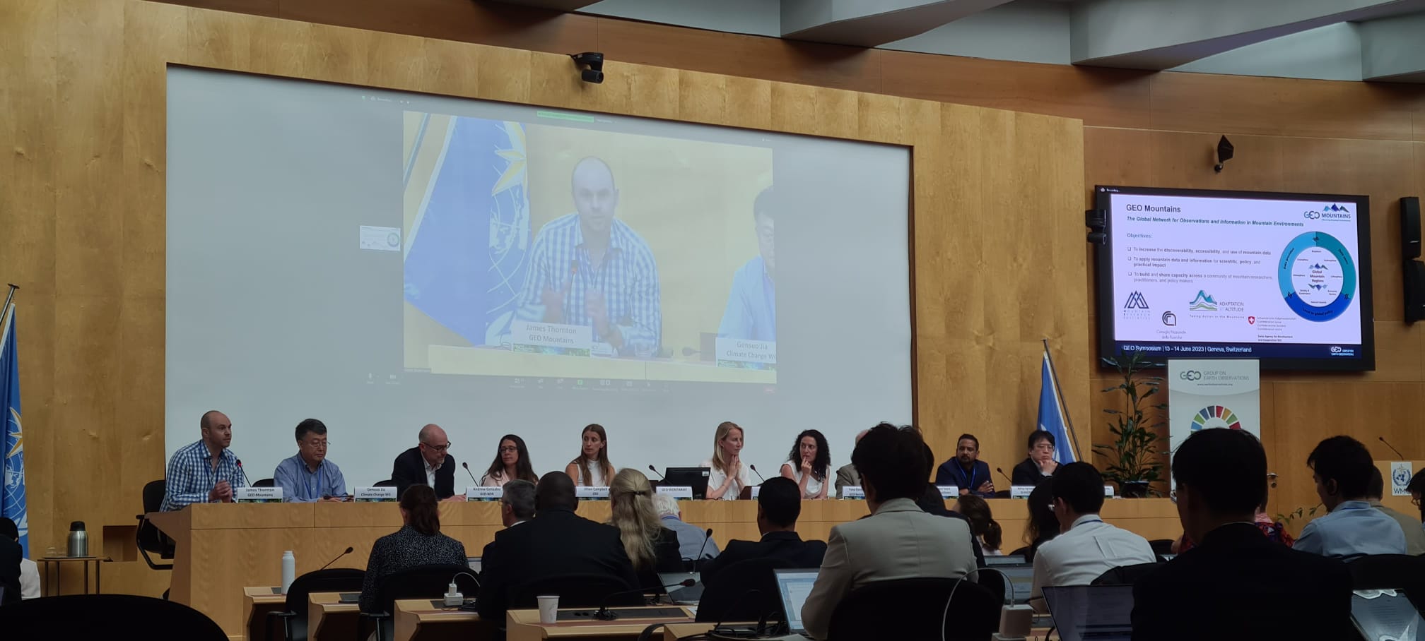
Dr. James Thornton, GEO Mountains Coordinator, contributed to the panel discussion of the thematic session on Biodiversity and Climate. Reflecting on the emerging Global Ecosystems Atlas project, Thornton suggested that in order capture the distinctive and highly dynamic nature of mountain ecosystems, some of the data layers must be highly resolved in space, frequently updated, an enable coherent time-series analysis. He agreed that providing a great deal of choice (e.g. in terms of datasets) is excellent, but must be accompanied by sufficient guidance to users so as to not overwhelm them.
The Open Data & Open Knowledge Workshop served as a platform for knowledge sharing and collaboration. The introductory remarks and numerous case studies given emphasised the importance of Open Data and Open Knowledge for informed decision-making, environmental monitoring, and community empowerment. The contributions from across the GEO Work Programme and subsequent discussions also shed light on the challenges and opportunities in implementing Open approaches in various regions and disciplines.
Edoardo Cremonese, GEO Mountains member and researcher at the Environmental Protection Agency of Aosta Valley, gave an insightful and passionate talk about the need for actionable data in the mountains. He highlighted the importance of finding a balance between efforts to identify “data needs” and seeking to develop new datasets on the one hand, and simply getting on and employing what we already have to address increasingly urgent policy needs on the other. After showing some examples of GEO Mountains' work, including our In Situ Inventory and efforts towards the definition of Essential Mountain Climate Variables (EMCVs), he gave a series of excellent recommendations for possible ways forward.
GEO Mountains was also represented at the ODOK workshop by James Thornton. Thornton contributed a tutorial for computing zonal statistics over complex geometries in an efficient and reproducible fashion using PostGIS. Participants developed the capacity to efficiently summarise and map spatio-temporal dynamics represented in gridded geospatial datasets over regions of interest. The notebook used is freely available and can be readily adapted to specific applications. The recording of the tutorial will be available soon.
Thornton then gave a presentation on the topic of human populations in the world’s mountains. Understanding population dynamics in mountainous areas is crucial, and the aim of the research was to develop an open workflow to address several associated research questions. Globally, mountain population estimates were shown to be highly variable depending upon the input dataset choices. Associations with climatic and other factors were also explored, enabling (for instance) the extent to which mountain population densities are higher than overall population densities in dry and hot regions was quantified. Find out more about this research here.
Staff from the GEO Mountains Secretariat also took the opportunity to follow other hands-on demonstrations, such as the session on Satellite Image Time Series Analysis of Earth Observation Data Cubes, which was given by Dr. Gilberto Camara.
Further resources
-
GEO Knowledge Hub. (2023). Open Data and Open Knowledge Workshop (2023). GEO Knowledge Hub. https://doi.org/10.60566/pfty5-y6482 (sessions under "Other" tab)
- Photos from the workshop
All sessions were recorded and will be available on the GEO website soon.
Cover image by GEO Mountains